 SwissEnvEO
Enhanced Vegetation Index (EVI) - Sentinel-2 [2016-2021] - Switzerland
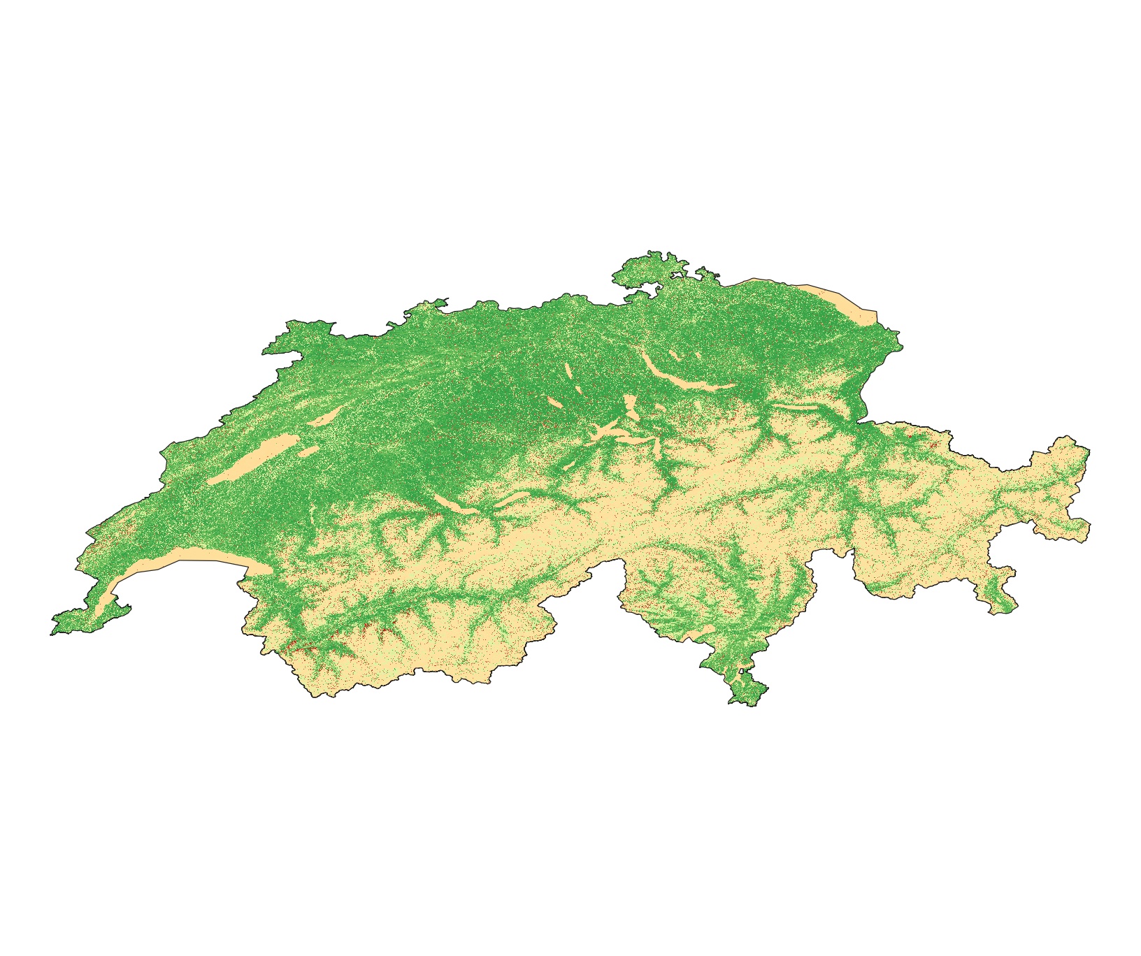
This dataset is an time-serie of Sentinel-2 Analysis Ready Data (ARD)- derived Enhanced Vegetation Index (EVI) computed from Sentinel-2 data. EVI quantifies vegetation by measuring the difference between near-infrared (which vegetation strongly reflects) and red light (which vegetation absorbs) using the forumla EVI=2.5*(b8 − b4)/(b8 + 6*b4 − 7.5*b2 + 1). See Huete et al. (2002) DOI: 10.1016/S0034-4257(02)00096-2 EVI is usually used for areas with high LAI where NDVI is expected to saturate. EVI is used to quantify vegetation greenness and is useful in understanding vegetation density and assessing changes in plant health.
EVI values ranges from -1 to +1.
Values are provided as integer and multiplied by 1000
Metrics: annual (_annual) and seasonal (_spring; _summer; _autumn; _winter) mean (_nanmean), standard dev (_nanstd), min (_nanmin), max (_nanmax), median (_nanmedian), and amplitude (_range)
Data format: GeoTiff
Simple
- Date (Publication)
- 2022-10-03
- Status
- Completed
- Maintenance and update frequency
- As needed
- Keywords
-
- Keywords
-
-
vegetation
-
evi
-
-
geocat.ch
-
-
landscape model
-
raster data
-
nature
-
- Access constraints
- Other restrictions
- Use constraints
- otherRestictions
- Other constraints
-
Creative Commons Attribution 4.0 International
- Spatial representation type
- Grid
- Denominator
- 25000
- Language
-
eng
- Character set
- UTF8
- Topic category
-
- Imagery base maps earth cover
- Environment
- Geoscientific information
))
- Begin date
- 2016-01-01
- End date
- 2021-12-31
- Reference system identifier
- CH1903+ / LV95 - EPSG:2056
- Number of dimensions
- 2
- Dimension name
- Row
- Dimension size
- 30
- Resolution
- 30 meters
- Dimension name
- Column
- Dimension size
- 30
- Resolution
- 30 meters
- Dimension name
- Vertical
- Dimension size
- 0
- Resolution
- 0 meters
- Cell geometry
- Area
- Distribution format
-
-
(
)
-
(
)
- OnLine resource
- Enhanced Vegetation Index (EVI) - Switzerland [2016, Sentinel-2] ( DOI )
- OnLine resource
- Enhanced Vegetation Index (EVI) - Switzerland [2017, Sentinel-2] ( DOI )
- OnLine resource
- Enhanced Vegetation Index (EVI) - Switzerland [2018, Sentinel-2] ( DOI )
- OnLine resource
- Enhanced Vegetation Index (EVI) - Switzerland [2019, Sentinel-2] ( DOI )
- OnLine resource
- Enhanced Vegetation Index (EVI) - Switzerland [2020, Sentinel-2] ( DOI )
- OnLine resource
- Enhanced Vegetation Index (EVI) - Switzerland [2021, Sentinel-2] ( DOI )
- Hierarchy level
- Dataset
- Statement
-
This dataset has been produced using Sentinel-2 data from the Swiss Data Cube
- File identifier
- c491ef64-91b8-42ec-b317-27ce61b4f2c1 XML
- Metadata language
- English
- Character set
- UTF8
- Date stamp
- 2024-08-13T08:32:08
- Metadata standard name
-
ISO 19115:2003/19139
- Metadata standard version
-
1.0
Overviews
Spatial extent
Provided by
