 SwissEnvEO
Leaf Area Index (LAI) - Landsat [1984-2021] - Switzerland
This dataset is an time-serie of Landsat Analysis Ready Data (ARD)- derived Leaf Area Index (LAI) computed from Landsat 5-7-8 data. LAI is designed to analyze the foliage surface of our planet and it estimates the quantity of leaves in a specific region using the forumla LAI= 3.618*EVI - 0.118. For more details see Boegh et al. (2002) DOI: 10.1016/S0034-4257(01)00342-X LAI is a unitless measure that is calculated as the ratio of the one-sided (illuminated) foliage area to the soil surface it can cover. This vegetation index is important to monitor crop and forest health, the environment, and climatic conditions.
Values are provided as integer and multiplied by 1000
Metrics: annual (_annual) and seasonal (_spring; _summer; _autumn; _winter) mean (_nanmean), standard dev (_nanstd), min (_nanmin), max (_nanmax), median (_nanmedian), and amplitude (_range)
Data format: GeoTiff
Simple
- Date (Publication)
- 2022-10-03
- Status
- Completed
- Maintenance and update frequency
- As needed
- Keywords
-
- Keywords
-
-
vegetation
-
lai
-
-
geocat.ch
-
-
landscape model
-
nature
-
Landsat
-
raster data
-
- Access constraints
- Other restrictions
- Use constraints
- otherRestictions
- Other constraints
-
Creative Commons Attribution 4.0 International
- Spatial representation type
- Grid
- Denominator
- 25000
- Language
-
eng
- Character set
- UTF8
- Topic category
-
- Imagery base maps earth cover
- Environment
- Geoscientific information
))
- Begin date
- 1984-01-01
- End date
- 2021-12-31
- Reference system identifier
- CH1903+ / LV95 - EPSG:2056
- Number of dimensions
- 2
- Dimension name
- Row
- Dimension size
- 30
- Resolution
- 30 meters
- Dimension name
- Column
- Dimension size
- 30
- Resolution
- 30 meters
- Dimension name
- Vertical
- Dimension size
- 0
- Resolution
- 0 meters
- Cell geometry
- Area
- Distribution format
-
-
(
)
-
(
)
- OnLine resource
- Leaf Area Index (LAI) - Switzerland [1984-1989, Landsat] ( DOI )
- OnLine resource
- Leaf Area Index (LAI) - Switzerland [1990-1999, Landsat] ( DOI )
- OnLine resource
- Leaf Area Index (LAI) - Switzerland [2000-2009, Landsat] ( DOI )
- OnLine resource
- Leaf Area Index (LAI) - Switzerland [2010-2019, Landsat] ( DOI )
- OnLine resource
- Leaf Area Index (LAI) - Switzerland [2020-2021, Landsat] ( DOI )
- Hierarchy level
- Dataset
- Statement
-
This dataset has been produced using Landsat data from the Swiss Data Cube
- File identifier
- c5bc0095-4b9d-4a50-9c17-a2e5c08c4c9c XML
- Metadata language
- English
- Character set
- UTF8
- Date stamp
- 2024-08-13T08:28:55
- Metadata standard name
-
ISO 19115:2003/19139
- Metadata standard version
-
1.0
Overviews
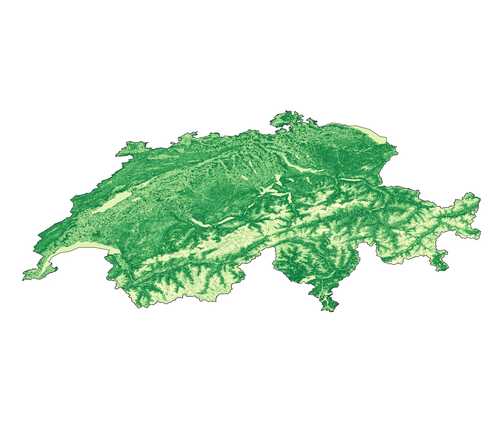
Spatial extent
Provided by
