Snow Cover - Monthly [1984-2021]
This dataset is a time-series of monthly snow cover maps over Switzerland computed from Landsat & Sentinel-2 Analysis Ready Data (ARD) for December 1984 to December 2021
These maps quantify the presence/absence of snow using the Snow Observation from Space algorithm developed by Poussin et al. in: https://doi.org/10.1016/j.srs.2023.100078 and in a submitted paper (Snow Observation from Space: An approach to map snow cover from four decades of Landsat and Sentinel-2 imageries across Switzerland).
Snow cover is an Essential Climate Variables (ECV) playing a significant role in the climate system due to its high albedo and heat insulation. Snow cover also contributes to soil moisture and runoff, making it a crucial variable for monitoring climate change.
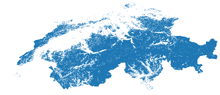
Values ranges from 0 to 2. The monthly snow cover products have values ranging from 0 to 2 with the following classification for each pixel:
• 0 when the pixel is snow-free (i.e., land),
• 1 when the pixel is covered with snow,
• 2 when the pixel is covered with clouds (including cloud shadow),
• NA when the pixel is classified as water or lies outside of Switzerland.
Data format: GeoTiff
Simple
- Date (Publication)
- 2024-08-07
- Status
- Completed
- Maintenance and update frequency
- As needed
- Keywords
-
- Keywords
-
-
snow
-
water
-
-
geocat.ch
-
-
landscape model
-
nature
-
Landsat
-
raster data
-
- Access constraints
- License
- Use constraints
- License
- Other constraints
-
Creative Commons Attribution 4.0 International
- Spatial representation type
- Grid
- Denominator
- 25000
- Language
-
eng
- Character set
- UTF8
- Topic category
-
- Imagery base maps earth cover
- Environment
- Geoscientific information
))
- Begin date
- 1984-01-01
- End date
- 2021-12-31
- Reference system identifier
- CH1903+ / LV95 - EPSG:2056
- Number of dimensions
- 2
- Dimension name
- Row
- Dimension size
- 30
- Resolution
- 30 meters
- Dimension name
- Column
- Dimension size
- 30
- Resolution
- 30 meters
- Dimension name
- Vertical
- Dimension size
- 0
- Resolution
- 0 meters
- Cell geometry
- Area
- Distribution format
-
-
(
)
-
(
)
- OnLine resource
-
Snow Cover - Monthly [1984-2021] - Switzerland
(
WWW:LINK-1.0-http--link
)
Yareta Repository
- OnLine resource
-
sdc:snowcover
(
OGC:WMS
)
snowcover
- Hierarchy level
- Dataset
- Statement
-
This dataset has been produced using Landsat and Sentinel-2 data from the Swiss Data Cube
- File identifier
- d98b8938-22fb-450e-ae1d-af078b6307c8 XML
- Metadata language
- English
- Character set
- UTF8
- Date stamp
- 2024-08-13T14:24:00
- Metadata standard name
-
ISO 19115:2003/19139
- Metadata standard version
-
1.0
Overviews
Spatial extent
Provided by